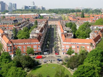
Rivierenbuurt forms a part of the Berlage's meticulous urban expansion project Plan Zuid (the South Plan). While the Apollobuurt and Stadionbuurt to the southwest were aimed at the more affluent residents, the middle class as well as the working class, the Rivierenbuurt was primarily meant for the middle class. The neighborhood was built in the 1920s and 1930s. Three broad boulevards - Churchilllaan, Rooseveltlaan, and Victorielaan - traverse the district in a Y-shape and converge at the Victorieplein (Victory Square), while most of the smaller streets in the neighborhood are named after Dutch rivers. This street, for instant, bears the name of a pretty river that branches off the Rhine, then flows through various towns in the provinces of Utrecht and North Holland before discharging into the IJ lake near the historic town of Muiden.
In 1921, the Public Works Department of the City of Amsterdam leased a sizable plot of expropriated land northeast of the Victory Square out to the Amstel Residential Corporation, wherein 71 construction companies were involved. The latter eventually constructed 1739 small limited-budget suburban houses with rents going between 11 and 20 Dutch guilders per week. In 1925 the houses were completed, although 16 of the companies involved in construction were unable to get to work right away and, thus, did not fulfill their obligations. Consequently, the municipality took over their real estate. In this manner, the Municipal Housing Department received a considerable number of properties in the Rivierenbuurt (the Rivers District), namely the areas south of the Amstelkade and north of the current Vrijheidslaan and Churchilllaan.
The Rivers District, as well as most of the buildings from that era and in the southern part of Amsterdam, were designed in the style of the Amsterdam School. Buildings in this style are characterized by brick construction with complicated masonry that suggests fluid or organic appearance. The style also put considerable emphasis on decorative masonry, stained glass, wrought ironwork, spires or "ladder" windows (windows with horizontal bars) and integrated architectural sculpture. The aim was to create a total architectural experience, both in the interior and the exterior. Renown architects such as Margaret Steel Kropholler, Michel de Klerk and Piet Kramer were commissioned to construct in this district.
From 1933 onward, many Jewish refugees from Nazi Germany settled in this part of town. By 1940, about 40% of the Amsterdam Jews populated this neighborhood. Anne Frank and her family lived at Merwedeplein from 1933 to 1942. At the outbreak of World War II, the district counted close to 17,000 Jewish inhabitants, 13,000 of whom did not survive the war, having been murdered in extermination and concentration camps. Many of those who survived left Amsterdam and the Netherlands for other shores. Nowadays, the neighborhood still counts some of the Jewish population which has survived and grown marginally since the war.
On the facades (as the well as on some backs) of the buildings in the district one can still spot hand-painted numbers. These were made by the residents themselves and not by the Nazis, as is assumed by some, because after the curfew entire streets lay in darkness and it was impossible to tell which house was which.
To the east of the Riverenbuurt is the Berlage Bridge built over the Amstel river in 1932. It was over this bridge that the Canadian liberators entered Amsterdam on May 8, 1945, now the official Liberation Day in the country. To the south of the Rivierenbuurt is the Rivierenlaan (the Rivers Boulevard). After the assassination of John F. Kennedy in 1963, it was renamed President Kennedylaan. Martin Luther King Park located next to it is named after African-American civil rights activist murdered in 1968